")


")


每月給付金將在明年提升2.8%🔼")


卸妝濕巾檢測含有細菌?!😯")


")


")

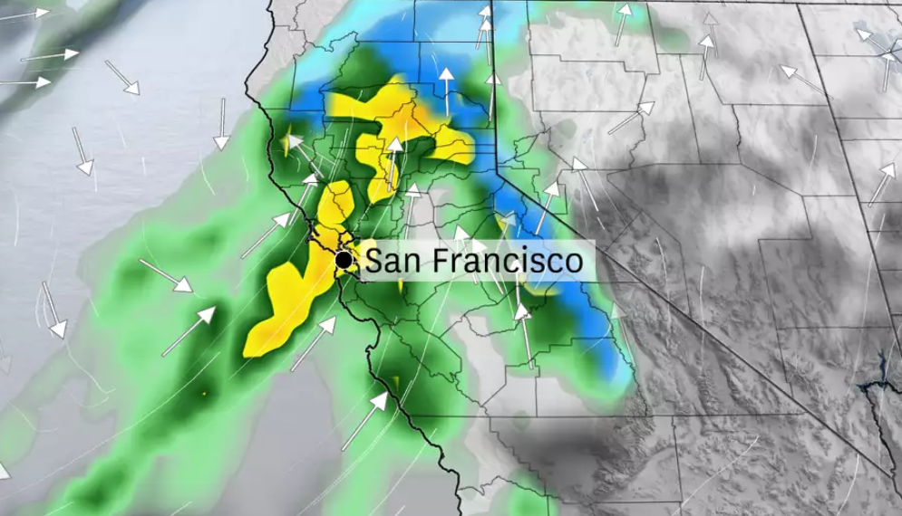
當心~灣區將面臨一場強烈的大氣河流暴風雨!!
北加州的天氣將持續受到長時間大氣河流的影響,隨著大氣河流逐漸向灣區移動,預計週一晚上至週二,降雨將進一步加劇,將帶來大量降雨,並有可能引發洪水。
根據美國國家氣象局的預報,從1月31日(上週五)開始,這場風暴將持續影響北加州和灣區,降雨量預計達到1至3英寸。
舊金山的降雨高峰尚未到來,塞拉山脈(Sierra Nevada)則準備迎接可能是本季最強的降雪週。
此外,內華達山脈的高山地區可能會出現數英尺的降雪,這可能是今年以來最強的暴風雪之一。
整個灣區的降雨量預計將達到0.5至1.5英寸,其中北灣的降雨量最大,南灣和聖塔克魯茲的降雨量較少。
A cold front is expected to move slowly across the Bay Area on Tuesday, resulting in significant rainfall. Up to 4 inches of rain could fall in 24 hours in San Francisco and Oakland if the front stalls.
由於降雨量大,土壤達到飽和,也相對增加了洪水的風險。
美國國家氣象局已經發布了洪水觀察警報,提醒居民注意可能的洪水風險。建議密切關注最新的天氣預報,並為可能的洪水做好準備。
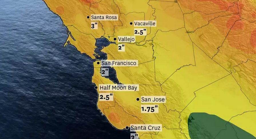
The National Weather Service forecasts 1 to 4 inches of rain across the Bay Area through Wednesday afternoon, with much of the precipitation falling Tuesday.
Comments
Category: Default, Featured, full images, News 新聞, Whats Hot, 資Information